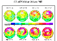
CLAES_O3_N8
Polar orthographic projections of 24 hours of ozone data at 21 km as measured by CLAES in the Arctic stratosphere for individual days between July 1992 and May
1993. These days emphasize the northern vortex region and the ozone depletion therein. |
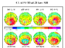
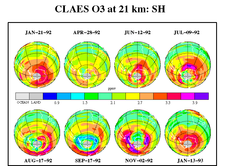
CLAES_O3_S8
Polar orthographic projections of 24 hours of ozone data at 21 km as measured by CLAES in the Antarctic stratosphere for individual days between January 1992
and January 1993. These days emphasize the southern winter vortex region and the ozone hole therein.
|
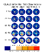
CLAES_PSC_S20A multi-level view of polar stratospheric clouds for selected days during the Antarctic winter of 1992 as observed by CLAES on UARS. Thermal emission is
measured on the Earth's limb and mathematically inverted to retrieve the absorption coefficient values shown here. CLAES acquired data through the polar night to
achieve a unique look at the mid and late season 3-D distribution PSC's. Temperature contours at 187 and 193K from the UKMO are overlayed to show the
correspondence with areas near the ice and NAT frost points.
|
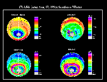
CLAES_S4_MIX_INVB
Polar projections at 21 km are shown for the CLAES temperature, aerosol, ClONO2, and HNO3 data during the southern winter on August 17, 1992. Both the
ClONO2 and HNO3 fields have assumed a structure characterized by a band or collar region of high values outside the vortex edge, as defined by the steepest
temperature gradient, which surrounded the coldest temperatures within the vortex region. High aerosol extinction coefficients are seen within the coldest areas,
indicating the presence of PSCs. [For more information see Figures 10-13 and their discussion in "Observations of Lower-Stratospheric ClONO2, HNO3, and
Aerosol by the UARS CLAES Experiment between January 1992 and April 1993", by Roche et al., J. Atmos. Sci., 51, 2877-2902, Oct. 15, 1994.]
|
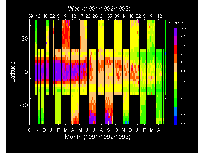
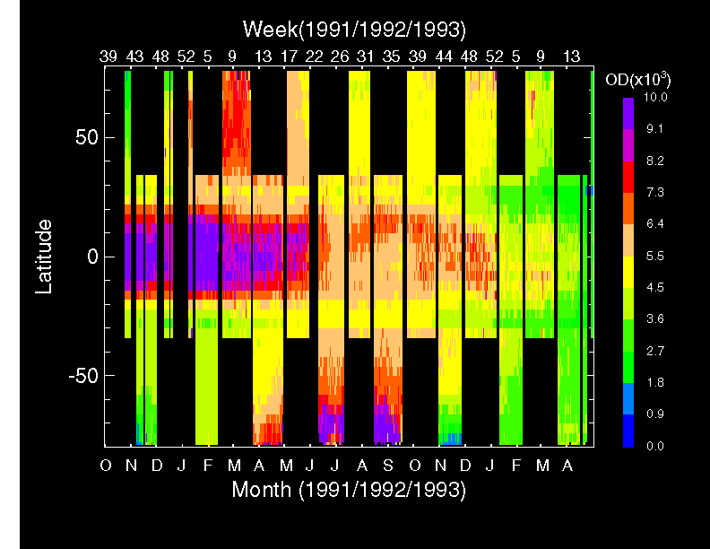
CLAES_STRAT_AEROSOL_OD
The decay and dispersal of the Mt. Pinatubo stratospheric aerosol veil measured by the CLAES instrument on the Upper Atmosphere Research Satellite. In the first
half of the dataset very high optical depths associated with volcanic aerosol are confined to +/-20 degrees latitude with seasonal dispersal into the winter hemisphere.
Also shown are high optical depths in the Antarctic winter when polar stratospheric clouds (PSC's) appear inside the Antarctic polar vortex, and the clean southern
vortex air in November of 1991 and 1992 after the PSC's have gone. [see paper by Mergenthaler et al., Geophys. Res. Lett, 22, 3497-3500, 12/15/95, entitled,
"CLAES observations of Mt. Pinatubo stratospheric aerosol".]
|
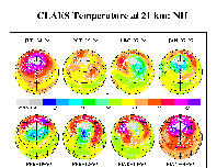
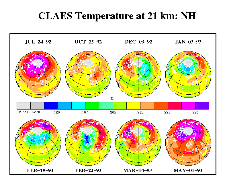
CLAES_TEMP_N8
Polar orthographic projections of 24 hours of temperature data at 21 km as measured by CLAES in the Arctic stratosphere for individual days between July 1992
and May 1993. These days emphasize the northern winter vortex region and the decreased temperature therein. [Similar to figures and discussion in "Observations
of Lower-Stratospheric ClONO2, HNO3, and Aerosol by the UARS CLAES Experiment between January 1992 and April 1993", by Roche et al., J. Atmos. Sci.,
51, 2877-2902, Oct. 15, 1994.]
|


