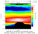
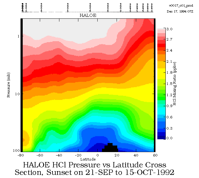
HALOE_HCL
HALOE sunset zonal mean HCl from 21-Sep to 15-Oct-1992. |
HALOE_HF
HALOE sunset zonal mean HF from 21-Sep to
15-Oct-1992.
|
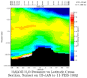
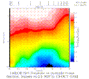
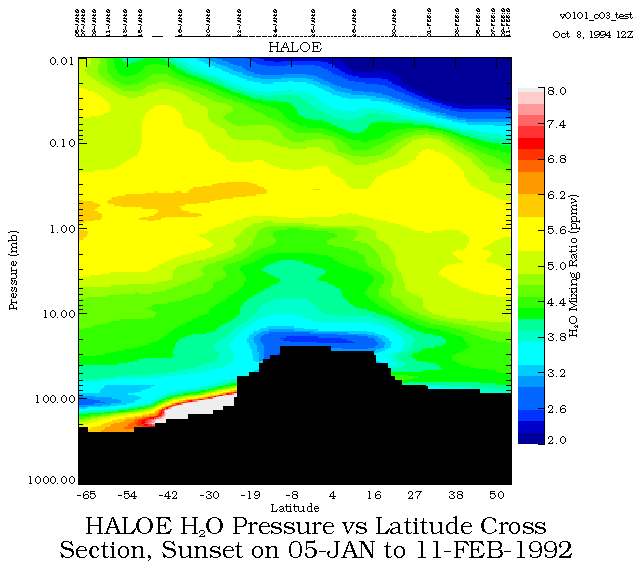
HALOE H2O
HALOE sunset zonal mean H2O from the ground to 0.01 mbar over the 05-Jan to 11-Feb-1992 time period.
|
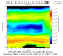
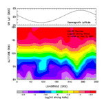
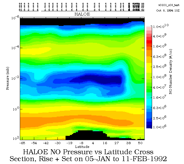
HALOE NO
HALOE sunset and sunrise zonal mean NO from 100 to 0.000001 mbar
over the 05-Jan to 11-Feb-1992 time period.
|
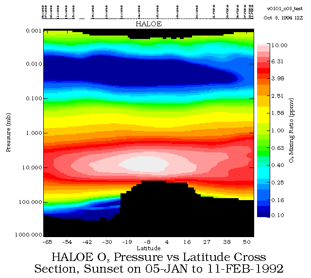
HALOE O3
HALOE sunset zonal mean O3 from the ground to 0.001 mbar over the 05-Jan to 11-Feb-1992 time period.
|
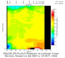
HALOE 2CH4+H2O
HALOE sunset zonal mean 2*CH4+H2O from 22-Sep to 15-Oct-1992.
|
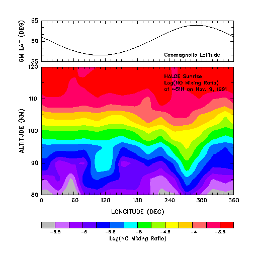
HALOE NO 1
HALOE sunrise NO at 51N on Nov. 9, 1991
(taken from Fig. 2, Luo et al., GRL, 20, 1307-1310, 1993).
|

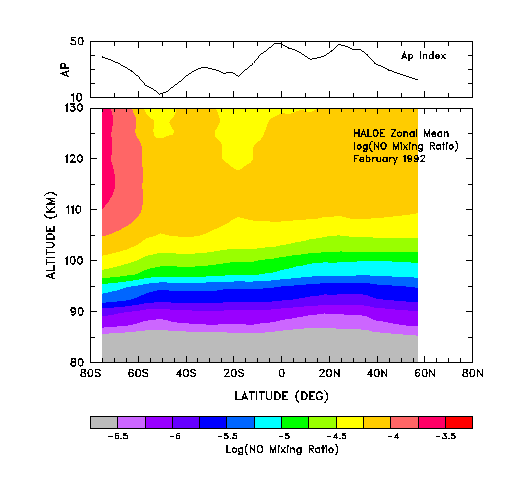
HALOE NO 2
HALOE sunrise zonal mean NO for Feb., 1992
(taken from Fig. 3, Luo et al.,GRL, 20, 1307-1310, 1993).
|
|
