Heavy smoke in the West Pacific, where lack of convection and rain caused fires, set for agricultural purposes, to rage out of control.
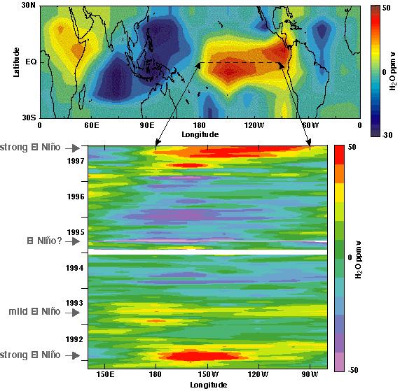
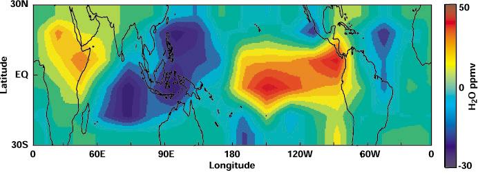
December 1-2, 1997, MLS measurements of relative changes in upper tropospheric water vapor reflect the pattern of tropical rainfall during El Niño. Normally, heavy rains occur over the west Pacific, but MLS shows that the upper tropospheric water vapor has moved east as warm waters formed off South America.
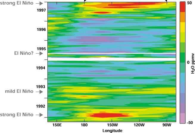
Time Series of relative changes in equatorial, upper tropospheric water vapor over the east Pacific. El Niño events appear as an increase in water vapor in this region.
 |
 |
|
Last modified: March 08, 2017